


- Coral reefs, medieval coastal castles and mangrove forests on UNESCO’s World Heritage list now share something in common: Precise digital boundaries.
- A new dataset maps 386 coastal World Heritage Sites, offering the clearest picture yet of what stands to be lost as the world’s climate changes.
- Covering 235 million hectares (~581 million acres) of coastline, the new high-resolution, open-access dataset can be used by researchers and local managers to study flooding, erosion and other climate risks faced by heritage sites.
- The tool is a critical first step to understand climate risks, but not a substitute for the local knowledge needed to help these places survive, some experts say.
Whenever coastal engineer Robert Nicholls looks outside one of his home’s windows, he can see the Hurst Castle Spit on the south coast of England slowly eroding across the sea. “In a way, Hurst Castle is a part of me, because I did all my Ph.D. work on the spit.”
Although this particular castle doesn’t have an international heritage status, it inspired Nicholls to study how climate change and weather events threaten the survival of such sites across the globe. Now, Nicholls has co-created the first global high-resolution digital dataset of UNESCO World Heritage Sites located along coastlines. Together, the included sites cover more than 235 million hectares (~581 million acres). Nicholls and his colleagues say the database can be used as a tool to help assess vulnerabilities of coastal sites that possess great natural and cultural significance, and local authorities can make them more resilient in the face of climate change and other threats posed by weather extremes.
“The surprising thing, I suppose, was the number of sites in the coastal zone,” Nicholls, a professor of climate adaptation at the University of East Anglia, told Mongabay over a video call.
The database, published in the journal Scientific Data in July, includes 386 locations and maps cultural landmarks; biocultural sites deemed to have both ecological and cultural value; and unique ecosystems, biodiversity fortresses and geological marvels. All are threatened by climate change and other environmental factors that might not be directly tied to it, such as erosion, according to co-author Joanne Clarke, an archaeologist and heritage specialist at the University of Durham in the United Kingdom.
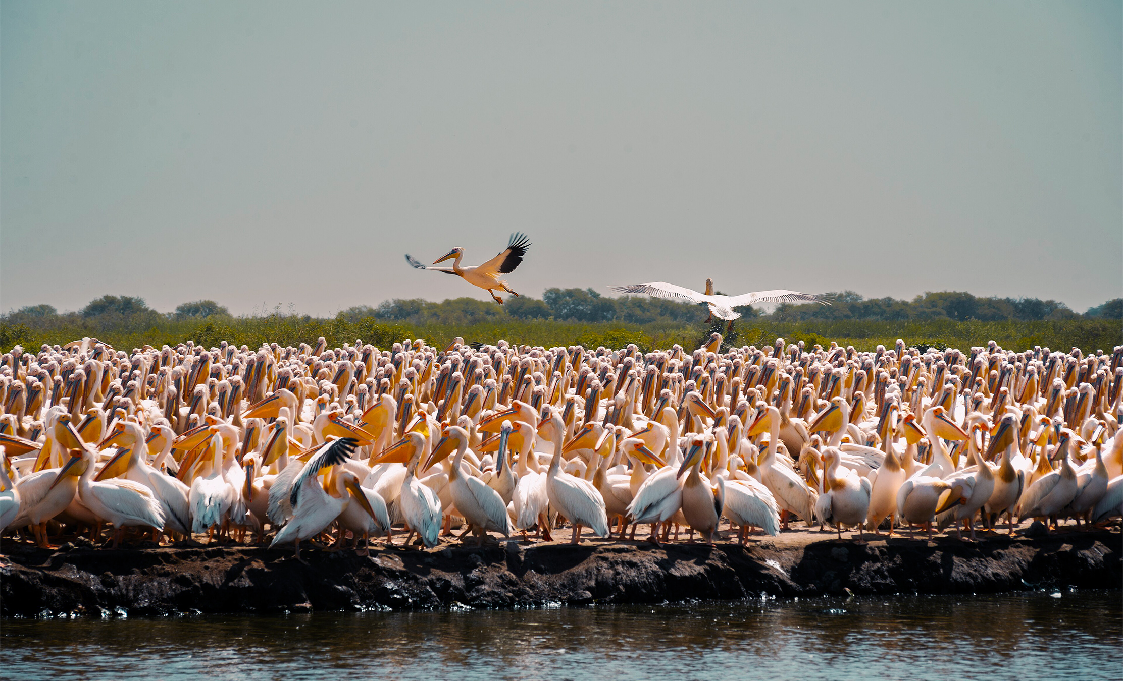
The dataset includes West African desert wetlands like Djoudj National Bird Sanctuary in Senegal and the Banc d’Arguin National Park in Mauritania, which are “unbelievable places with bird migration,” Clarke said. She added that melting glaciers and sites with remarkable wildlife — like Australia’s Great Barrier Reef and Greenland’s fjords — are also represented in the project.
A gap no one had filled
Until now, detailed digital boundary maps of heritage sites were often unavailable, which made it hard for researchers and managers to understand which sites are most vulnerable. “In some cases, our data might be the best data that exists, even at the local scale,” Nicholls said.
“I was quite surprised to find that UNESCO didn’t already have polygons of all of their World Heritage Sites,” Tom Dawson, a coastal heritage archaeologist and professor at the University of St. Andrews in Scotland who was not involved in the study, told Mongabay by phone. Polygons, closed shapes that map the exact outline and size of specific geographic areas, are key to measuring environmental risks. “I’m glad that somebody’s gone to the trouble to make them.”
Creating the dataset was pretty simple, but tedious work, according to Nicholls. First, the team downloaded UNESCO’s list of 1,199 World Heritage Sites as of 2023 across 173 countries and scanned for those less than 20 meters (66 feet) above sea level and close to the coast. Then, they looked for coordinates and maps — both digital and physical — of the 289 cultural, 91 natural and six mixed sites that matched the elevation criteria in places like Historic England’s Open Data Hub, the World Database of Protected Areas, or wetland-protection lists like RAMSAR. “Not all sites come with good maps,” Clarke told Mongabay in a video call.
Using existing data, the team of around 14 digitizers hand-drew the boundaries of each site. “We didn’t use any AI, we didn’t use machine learning or anything like that,” Clarke said. It was a painstaking process, as many places are a series of smaller structures, such as St. Petersburg in Russia, a complex network of canals, streets and quays that connect 126 locations, and islands and fortresses on the Gulf of Finland, the easternmost arm of the Baltic Sea. The researchers drew the perimeter of each island and fort by hand using Google Earth. The 386 heritage sites comprise a total of 1,250 individual polygons. “It’s an enormous amount of work,” Clarke said.
Dawson, whose work focuses on ground-level community monitoring, said he thinks local managers can use the dataset as a starting point for creating risk assessments, but that it cannot replace detailed, localized knowledge and data. “You really need to have the local climate models as well, because you can’t go and take the IPCC [U.N. Intergovernmental Panel on Climate Change] model and say, ‘this area here is one meter above sea level. So with one meter of sea level rise most of the sites disappear. It’s not as simple as that.”


The cascading risks of living heritage
Evaluating risks is particularly complex for natural and heritage sites with both cultural and ecological value. In cultural heritage sites, the question is “how to protect that castle on the hill from coastal erosion, or from wind erosion or flooding,” Clarke said. But in sites that have cultural and natural heritage status simultaneously, or those with purely natural value, “then you have compound cascading risks.”
In these places, climate change and other extreme weather events — such as water temperature increases that cause coral bleaching in Australia’s Great Barrier Reef — compound other threats. Wetlands face a changing climate at the same time they suffer pollution and agricultural exploitation in places like the Doñana National Park in Spain. Marine species struggle in a warming ocean as they are pressured by illegal activities like fishing in protected areas such as Malpelo Island, in Colombia. Other places face potential impacts from developing infrastructure, like the world’s largest mangrove ecosystem, the Sundarbans in Bangladesh, where there are plans to build Bangladesh’s biggest power plant yet just 14 kilometers (~8.7 miles) away.
“I think biocultural or ecological heritage, in some ways, is more fragile than some cultural heritage sites,” Clarke said.
The database can become an important tool to help researchers build complex risk assessments, which are fundamental when advocating for resources, said geologist Alessandra Bonazza, a research director at the National Research Council of Italy who did not participate in the study. “I really would like to integrate this database into the tool that we are developing at the Mediterranean and European level. It would be amazing to overlap our maps of climate hazards with this,” she said.

The researchers who authored the study are already using the dataset to look at potential flood implications of sea level rise for these sites in a forthcoming paper to be published in Nature Sustainability, Clarke said.
“We’re seeing a growth in global datasets of all kinds of things to do with the environment,” Nicholls said. “And there’s lots of things that you can do when you put them together. This is part of that global effort.”
Banner image: Great white pelicans (Pelecanus onocrotalus) at the Djoudj Bird Sanctuary in Senegal. Image by Dioufy01 via Wikimedia Commons (CC BY-SA 4.0).
Climate change is wreaking havoc on World Cultural Heritage sites, study finds
Green groups oppose Qatari luxury resort near pristine world heritage site
Citations:
Bescoby, D., Clarke, J., Okolie, C., Nicholls, R. J., Simpson, N. P., Vafeidis, A. T., … Vousdoukas, M. I. (2026). Mapping the global distribution of coastal world heritage sites: Glo-coh, a new global coastal heritage dataset. Scientific Data, 13(1). doi:10.1038/s41597-026-07758-3
Pain, D., Sánchez, A., … Meharg, A. (1998). The Doñana ecological disaster: Contamination of a world heritage estuarine marsh ecosystem with acidified pyrite mine waste. Science of The Total Environment, 222(1-2), 45-54. doi:10.1016/s0048-9697(98)00290-3
Feedback: Use this form to send a message to the editor of this post. If you want to post a public comment, you can do that at the bottom of the page.
Cite this article
María Paula Rubiano A. (2026). More than 380 coastal World Heritage Sites may face climate risks, new data shows. Mongabay Conservation news. DOI: https://doi.org/10.66709/news-327615

