


- To improve living conditions in Nigeria, new roads like the Lagos–Calabar Coastal Highway are needed.
- But these can and must be built in such a way that protects mangroves, swamps, and remnant forests, using knowledge and tools like environmental and social impact assessments.
- “The question is not whether Nigeria should develop. It is whether development will be intelligent enough to avoid destroying the natural infrastructure that already protects coastal communities,” a new op-ed argues.
- This article is a commentary. The views expressed are those of the author, not necessarily of Mongabay.
Nigeria needs road infrastructure for improved living conditions. Anyone who has watched trucks crawl out of Lagos, farmers and fishermen struggle to reach markets, or small coastal businesses lose value to poor logistics, knows that road infrastructure in Nigeria is not a luxury. The proposed Lagos–Calabar Coastal Highway, running roughly 700 kilometers (about 435 miles) from Badagry toward Calabar, is therefore easy to sell as a nation-building project: faster trade, more jobs, increased tourism, port access, socioeconomic development, and a stronger southern economic corridor.
However, the same road could also become a long concrete trigger for ecological loss. Nigeria’s coast is not empty land waiting for asphalt. It is a living system of mangroves, freshwater swamps, tidal channels, floodplains, fishing settlements, and remnant forests. These ecosystems store carbon, buffer storms, nurse fisheries, serve as breeding grounds for marine life, and support livelihoods that rarely appear in road-cost spreadsheets.
The question is not whether Nigeria should develop. It is whether development will be intelligent enough to avoid destroying the natural infrastructure that already protects coastal communities. The answer depends on whether environmental and social impact assessments, or ESIAs, are treated as honest decision-making tools rather than administrative rituals.
Recent developments have already raised serious concerns. Mongabay has noted that the highway passes through or near biodiversity hotspots, including areas associated with endangered Nigeria-Cameroon chimpanzees (Pan troglodytes ellioti) and critically endangered Niger Delta red colobus (Piliocolobus epieni), while questions remain about environmental assessment and compensation for affected communities. In Akwa Ibom state, civil society groups have warned against routing the project through Stubb’s Creek Forest Reserve, a gazetted mangrove-freshwater system established in 1930 and valued for biodiversity, flood control, fish breeding grounds, and local livelihoods.
These warnings should not be dismissed as anti-development; they are warnings against bad development. Roads do not only clear the land they physically occupy. In forest and wetland landscapes, they change hydrology, fragment habitats, and open new access for settlement, logging, sand mining, hunting, and land speculation. Wider road expansion in Africa has been shown to increase access to previously less-exploited forests and intensify pressure on wildlife habitats and protected areas.
For mangroves, the danger is often water, not just chainsaws. Embankments that block tidal exchange can reduce the tides, trap stagnant water, alter salinity, and weaken nursery grounds for fish and crustaceans. Hydrological changes in coastal lagoon and mangrove systems can produce ecological and socioeconomic degradation even when apparent mangrove area masks deeper loss of ecosystem integrity. A road built too cheaply across tidal channels can quietly kill an ecosystem long after the ribbon-cutting ceremony. The visible damage is concrete, demolition and clearing; the invisible damage is hydrological.
This is why a truthful ESIA matters. A useful assessment should answer simple questions before irreversible decisions are made: Which route avoids the most sensitive habitats? Which mangrove blocks, forest interiors, breeding sites, or community assets are no-go areas? What cumulative impacts will arise when the road combines with ports, estates, sand filling, logging access, and future urban expansion? What happens under sea-level rise and stronger storm surge? Who monitors compliance, and who pays when promises fail?

Reducing both the damage and the cost
The present Nigerian practice often falls short of that standard. Too many assessments describe the environment in broad prose but do not disclose route alternatives, high-resolution habitat maps, cumulative scenarios, raw spatial data, or independent review. When public display occurs after construction pressure has begun, participation becomes a formality.
So, communities are invited to comment on a moving train, essentially. But Nigeria can do better.
The coastal highway should be governed by an avoidance-first rule. Before engineers optimize for distance or cost, planners should publish a corridor-wide ecological sensitivity map showing protected areas, mangroves, freshwater swamps, tidal creeks, riparian buffers, forest reserves, community forests, erosion-prone coastlines, and known biodiversity records. My research team found that alternative-route analysis for Nigeria’s Cross River Superhighway could sharply reduce damage to intact forests, protected areas, and biodiversity, while also lowering estimated construction costs. Any segment crossing a legally protected area or irreplaceable nursery habitat should face a presumption of rerouting.
Where avoidance is genuinely impossible, the design should keep water moving. Elevated bridges, long-span causeways, and adequately spaced culverts are not decorative add-ons; rather, in tidal wetlands they are the difference between a road that coexists with fisheries and a road that suffocates them. Engineering choices should be tested against hydrodynamic modeling, not merely justified by convenience.

The ESIA should also be cumulative, because a road is rarely just a road. It reorganizes land value, attracts fuel stations, estates, markets, quarries, logging tracks, and informal settlements. Land-cover research in the Littoral region of Cameroon shows how road-linked land conversion, logging, plantations, and urban growth can fragment high-value tropical forests and threaten biodiversity over time. For the Niger Delta — already stressed by oil pollution erosion and weak land-use control — cumulative modeling is essential. The assessment must ask what the coast looks like after 10 or 20 years of induced development, not only what is cleared in year one.
Transparency is the cheapest safeguard. Route files, baseline biodiversity data, hydrology assumptions, resettlement plans, compensation schedules, and monitoring reports should be placed online in usable formats. Public consultation should occur in affected languages and communities before final alignment decisions, not only in distant halls after contractors are mobilized. If a route is environmentally superior, the evidence should be visible. If it is not, citizens deserve to know why it was chosen.
The likely outcome is that these measures reduce long‑term environmental liabilities, protect coastal livelihoods, and improve project sustainability and investor security.
Finance can make this real: Public money, private capital, and any multilateral support should be tied to verifiable environmental performance. Contractors should post performance bonds for mangrove restoration, drainage maintenance, and pollution control. Independent auditors, not project promoters, should verify compliance. If tidal channels are blocked, if unauthorized clearing occurs, or if protected areas are degraded, funds should be withheld and penalties triggered automatically.
There is precedent for this kind of thinking. Our research on alternative routes for the proposed superhighway showed that spatial planning can reduce damage to rare ecosystems and wildlife. Wider African road-impact literature warns that highways can accelerate forest loss far beyond the paved surface. Our study of mangrove and coastal lagoon systems showed that hydrological disruption can undermine ecosystem integrity and fisheries. These are not abstract lessons. They are directly relevant to a coastal corridor where engineering, urbanization, forests, fisheries, and climate risk meet.

Making a stronger case
The development case for the highway should therefore become stronger, not weaker, through stricter environmental rules. Investors do not benefit from litigation, community resistance, washed-out sections, damaged drainage, or reputational risk. Communities do not benefit from a road that erodes their fisheries, floods their homes, or devalues their forests. Government does not benefit from building an asset that becomes a climate liability.
Nigeria’s coastal states need connectivity, but they also need mangroves that break waves, forests that hold biodiversity, wetlands that store water, and fisheries that feed families. Treating those systems as obstacles is economically short-sighted. Treating them as infrastructure is smarter planning.
This highway can still be a constructive national project, but it must pass four tests:
- Avoid protected and high-value ecological zones;
- Elevate or bridge tidal crossings;
- Publish spatially explicit and cumulative ESIAs; and
- Make environmental promises enforceable through finance, monitoring and penalties.
Anything less is a gamble with ecosystems that Nigeria cannot easily replace.
If Nigeria builds this highway honestly, it can show that major infrastructure and coastal conservation are not enemies. If it builds first and assesses later, the country may gain a road while losing the natural defenses such as the declining mangrove footprint, fisheries, and forests that make coastal life possible.
The choice is not road or rainforest. The choice is careless construction or smart development.
Mahmoud Ibrahim Mahmoud is an environmental scientist and conservation geographer specializing in tropical land‑use change, coastal ecosystems, applications of geospatial information technologies for sustainability science, and the impacts of infrastructure on biodiversity and environment. He is chief environmental scientist with Nigeria’s National Oil Spill Detection and Response Agency (NOSDRA).
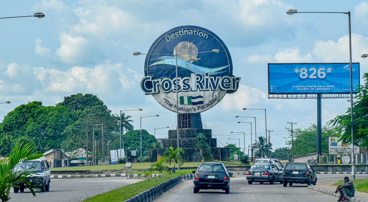
Banner image: Cross River Monument in Calabar, Nigeria, a city which would be connected to metropolis of Lagos via the new road. Image by Gaspard Lihouenou Koutchika via Wikicommons (CC BY-SA 4.0).
See related coverage:
Nigeria’s new coastal highway runs over communities & biodiversity hotspots
Before giant meat producer JBS expands to Nigeria, people deserve answers (commentary)
Citations:
Laurance, W. F., Campbell, M. J., Alamgir, M., & Mahmoud, M. I. (2017). Road expansion and the fate of Africa’s tropical forests. Frontiers in Ecology and Evolution, 5. doi:10.3389/fevo.2017.00075
Dahdouh-Guebas, F., Hettiarachchi, S., Lo Seen, D., Batelaan, O., Sooriyarachchi, S., Jayatissa, L., & Koedam, N. (2005). Transitions in ancient inland freshwater resource management in Sri Lanka affect biota and human populations in and around coastal lagoons. Current Biology, 15(6), 579-586. doi:10.1016/j.cub.2005.01.053
Mahmoud, M. I., Sloan, S., Campbell, M. J., Alamgir, M., Imong, I., Odigha, O., … Laurance, W. F. (2017). Alternative routes for a proposed Nigerian superhighway to limit damage to rare ecosystems and wildlife. Tropical Conservation Science, 10. doi:10.1177/1940082917709274
Mahmoud, M. I., Campbell, M. J., Sloan, S., Alamgir, M., & Laurance, W. F. (2019). Land-cover change threatens tropical forests and biodiversity in the Littoral Region, Cameroon. Oryx, 54(6), 882-891. doi:10.1017/s0030605318000881
Ansah, C. E., Abu, I., Kleemann, J., Mahmoud, M. I., & Thiel, M. (2022). Environmental contamination of a biodiversity hotspot—Action needed for nature conservation in the Niger Delta, Nigeria. Sustainability, 14(21), 14256. doi:10.3390/su142114256
Cite this article
Mahmoud Ibrahim Mahmoud (2026). Nigeria can build the new coastal highway and also protect natural areas (commentary). Mongabay Conservation news. DOI: https://doi.org/10.66709/news-327410

