


- Over the course of 2025, Cambodia, Laos, Myanmar, Thailand and Vietnam lost a combined 746,168 hectares of tree cover (1.8 million acres), including more than 154,000 hectares (380,000 acres) of primary forest, according to Mongabay’s analysis of data published by the University of Maryland and Global Nature Watch.
- However, the rate of deforestation in each country dropped when compared to 2024, continuing a decline that data show started in 2023.
- Experts say fewer wildfires, stricter enforcement and lower market rates for commodities could explain the drop.
- Mongabay’s analysis also found almost 200,000 hectares (494,000 acres) of forest loss occurred within protected areas, where deforestation risks should be lower.
BANGKOK — Over the course of 2025, the Mekong countries of Cambodia, Laos, Myanmar, Thailand and Vietnam lost a combined 746,168 hectares (1.8 million acres) of tree cover, an area roughly equivalent to the size of the Bangkok Metropolitan Area, according to Mongabay’s analysis*.
Data published by the Global Land Analysis and Discovery (GLAD) laboratory at the University of Maryland, in partnership with Global Nature Watch (GNW) — formerly Global Forest Watch — shows that of the total 746,168 hectares of tree cover lost, more than 154,000 hectares (380,000 acres) was primary forest. Mongabay’s analysis found that just shy of 200,000 hectares (494,000 acres) of the total were lost from the region’s protected areas.
While these numbers may paint a bleak picture for the Mekong’s forests, the rate of regional deforestation has dropped by almost 25% from that recorded by GNW in 2024, continuing a decline that, according to the data, began in 2023.
Fewer wildfires, higher rainfall, stricter law enforcement and lower market rates for commodities could all factor into a drop in the Mekong’s deforestation rate for 2025 when compared to 2024. However, experts warn that short-term drops do not always represent a broader trend in deforestation.
Every country in the Mekong saw a fall in deforestation rates from 2024 to 2025, but each still grapples with a range of challenges to protecting the region’s remaining forests.
Precarious protection in Cambodia
In 2025, GNW data shows Cambodia’s tree cover losses covered more than 59,000 hectares (146,000 acres) — roughly 0.33% of its total land area — making it the best year for the country’s forests since 2003. But while this reflects a roughly 50% drop in tree cover loss compared to 2023, Cambodia still lost more than 23,000 hectares (57,000 acres) of primary forest in 2025, which accounted for nearly 40% of the country’s total losses that year.
Mongabay’s analysis of deforestation data from GLAD shows that of the 59,000 hectares lost in Cambodia in 2025, nearly 32,000 hectares (79,000 acres), roughly 54%, vanished from protected areas, where deforestation should be more tightly controlled. The continued development of roads, energy infrastructure and mining operations — both legal and otherwise — pose major obstacles for Cambodia’s protected area management, which has long been stymied by the prevalence of logging.
The worst affected protected area was Beng Per Wildlife Sanctuary in northern Cambodia, with more than 4,400 hectares (11,000 acres) lost. Some of the tree cover loss reported there may include the felling of rubber trees since some 77% of the protected sanctuary has been converted from natural forest to land for growing a single crop like rubber, or monocropping, between 2002 and 2025.

In Prey Lang Wildlife Sanctuary, one of Cambodia’s most iconic and beleaguered protected areas, 4,068 hectares (10,000 acres) of tree cover were lost in 2025, compared to 9,340 hectares (23,000 acres) in 2024. The third worst affected protected area in Cambodia was Virachey National Park, which lost 3,216 hectares (7,947 acres) of forest cover, marking the worst year on record for one of Cambodia’s oldest national parks.
“Forests slowly die by degradation, death by a thousand cuts, 90% of forest loss happens by it long before the ultimate clearcut,” Marcus Hardtke, a veteran forest activist, told Mongabay in a phone interview. Clearcutting is the logging practice that removes all trees from an area at once. Hardtke stressed the need for on-the-ground investigations into what the deforestation data is showing.
“Protected area management in Cambodia still suffers from systemic problems, like organized corruption at all levels which undermines stated policy,” he added.

For Moeu Chandara, president of the Cambodian Youth Network, the data are both “encouraging” at the national level and “alarming” for individual protected areas. The decline, he told Mongabay in a phone interview, could be due to milder drought conditions, fewer wildfires than in 2024, slower rates of land clearing due to agricultural investments, and the loss or degradation of many accessible forests in prior years.
“Having protected status alone isn’t enough if enforcement efforts are weak, resources are scarce and illegal logging or land grabbing continue without accountability,” he said.

The invisible hand of the market at work in Laos
Laos recorded the highest rate of deforestation within the Mekong region for the year, with 230,200 hectares (569,000 acres) of tree cover lost in 2025 — equivalent to 1% of the country’s land area. However, even this represented a 34% drop compared to data for 2024.
For 2025, about one third of the total 230,200 hectares lost was primary forest, according to GNW data, while Mongabay’s analysis found nearly 146,000 hectares (363,000 acres) of tree cover was lost from protected areas.
The lower rate of deforestation in 2025 compared to 2024 might look impressive, but it’s worth noting that 2023 was the worst year on record for tree cover loss in Laos when the country lost nearly 2% of its remaining primary forests in a single year.

Protected areas in the central province of Bolikhamxay and the northern province of Luang Prabang saw the worst deforestation in 2025, according to Mongabay’s analysis using GLAD data and protected area boundaries shared by a source who requested anonymity owing to fear of retaliation from the government.
According to Phuc Xuan To, a senior analyst at environment finance nonprofit Forest Trends, forest clearance linked to agricultural commodities has likely overtaken the timber trade as a driver of deforestation in Laos. Cassava, bananas, rubber, coffee, durian and other crops — much of which are exported to China — have all resulted in widespread deforestation in recent years.
The fluctuations in supply and demand for cassava, Phuc said, could explain why Laos’s deforestation rate dropped so significantly from 2024 to 2025. Cassava was a key driver of deforestation during the Covid-19 pandemic, with cassava cultivation areas expanding for domestic consumption in Laos and Cambodia, because farmers didn’t have enough to eat. After the pandemic, global trade recommenced and, having expanded cultivation areas, both Laos and Cambodia had to increase exports of cassava. The increased supply also saw the crop’s price drop in 2024, resulting in a slowdown of cassava planting across the region.

“So I think the trend of forests being cut down, giving way to cassava, has slowed down,” he said. “Because the production was higher than demand in 2024, we didn’t see a lot of expansion in 2025 anymore.”
By contrast, timber exports from Laos to Vietnam have fallen from some million cubic meters per year in the late 2000s to around 10,000 cubic meters per year now, said Phuc. He added that the demand for luxury timber has declined in tandem with its dwindling availability and accessibility in natural forests across Laos and Cambodia. Entire villages in Vietnam were dedicated to importing — and often smuggling — luxury timber from Laos and Cambodia to feed the Chinese furniture market. Based on Phuc’s observations, however, these traders have since switched careers as the trade has diminished in recent years.

Illicit economies cash in on Myanmar’s forests
Myanmar, the largest country in the Mekong region by land area — nearly four times the size of Cambodia, three times the size of Laos and more than twice the size of Vietnam — had only the second highest rate of tree cover loss in 2025, according to GNW data. The GNW data show nearly 227,000 hectares (561,000 acres) were lost, equivalent to 0.34% of the country’s total land area. Of the year’s losses, close to 33,000 hectares (81,500 acres) or around 14% was primary forest.
Mongabay’s analysis found that tree cover loss across the 62 protected areas that were established before the 2021 coup was minimal, accounting for just 2.5% of the total recorded in 2025. The Myanmar military has lost control of the country’s largest forested areas and so the current status of these protected areas remains difficult to determine.
The total tree cover loss recorded by GNW reflects a roughly 18% drop from 2024 figures, but Shan State, in the country’s east, saw only marginal declines in deforestation rates, with more than 78,500 hectares (194,000 acres) lost across 2025. This was more than Chin and Karen states, the second and third worst affected respectively, combined.
Thant Zin Maw, a Burmese forestry expert displaced by the coup, said that deforestation was likely higher in these states as they share borders with China, India and Thailand, which have historically all been markets for illicit timber sales.
Forest Trends reported a $633 million discrepancy between reported imports and exports of forest products from Myanmar, suggesting high volumes of timber trafficking with China, India and Thailand listed as the top three destinations.
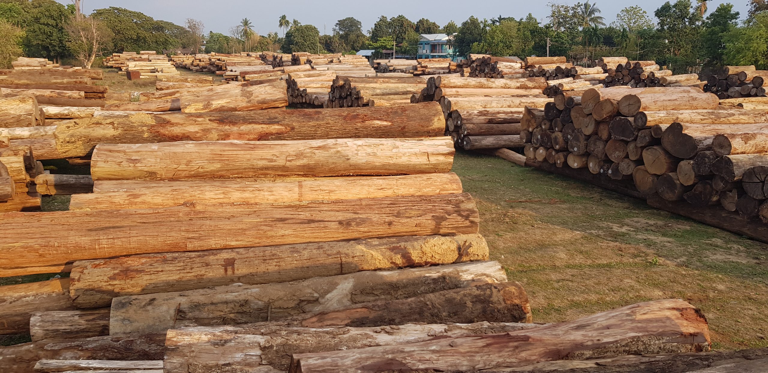
“There are illegal logging practices by timber extraction companies transporting timber through war zones by paying taxation to the military government or armed groups, depending on which group is dominant at those ground sites,” Maw said. “Law enforcement is weak on the ground to control timber extraction. Moreover, [in] Shan, Chin and Karen [states], there are armed groups and [People’s Defense Forces, a pro-democracy armed wing of the exiled National Unity Government] or ethnic armed groups and [internally displaced people] running from urban or village deterioration.”
Many groups across all factions depend on natural resources, she said. Some finance their fight against the military or each other, others are simply clearing forest to farm and survive.
A mining boom has gripped large swathes of Myanmar in recent years, with ethnic armed groups seeking to burnish their war chests by extracting gold, jade, rare earth elements and other critical minerals, much of which is then sold to China. This rapid expansion has also contributed to deforestation and seen multiple rivers in Thailand, including the Mekong and Salween rivers, contaminated with suspected chemical runoff from unregulated mining operations.
Maw added that industrial-scale gold and jade mining had spread to the Hukaung Valley Wildlife Sanctuary and its extended boundaries — two sites that confer protection on more than 1.7 million hectares across the border of Kachin State and Sagaing Region — leading to forest clearance and water table contamination. These two protected areas were the two worst affected by deforestation in 2025, collectively losing nearly 2,600 hectares (6,400 acres) of tree cover, accounting for 44% of all losses in protected areas across Myanmar.
Satellite imagery of five separate mining sites across the Hukaung Valley protected areas shows significant expansion from 2024 to 2025, with additional data sourced from analyst Thomas van Linge suggesting these mines are contested between the Myanmar military and the opposing Kachin Independence Army.

Thai and Vietnamese forests still standing as law enforcement improves
Data from both Thailand and Vietnam reflect years of strengthening national conservation policies, forest governance and law enforcement, at least when compared to neighbors in the Mekong region, but are also a reflection of rekindled efforts to protect what’s left of domestic forest areas.
Thailand lost more than 111,500 hectares (275,500 acres) of tree cover, according to GNW data, but only 3,618 hectares (8,900 acres) were primary forest and Mongabay analysis found some 11,000 hectares (27,200 acres) of the total losses occurred in protected areas.
Similarly, GNW recorded a little more than 118,000 hectares (292,000 acres) of tree cover loss across Vietnam in 2025, of which more than 14,200 hectares (35,100 acres) were primary forest, but just shy of 3,300 hectares (8,200 acres) were lost from protected areas, as per Mongabay’s own analysis of GLAD data.
Tree cover loss in Thailand fell around 24% from 2024 to 2025, while in Vietnam, that decline was only 8% for the same period. Among all Mekong countries, Thailand’s forest losses were the smallest proportional to its land area in 2025, at just 0.21%, while Vietnam saw around 0.36% of its total land area deforested in the same year.
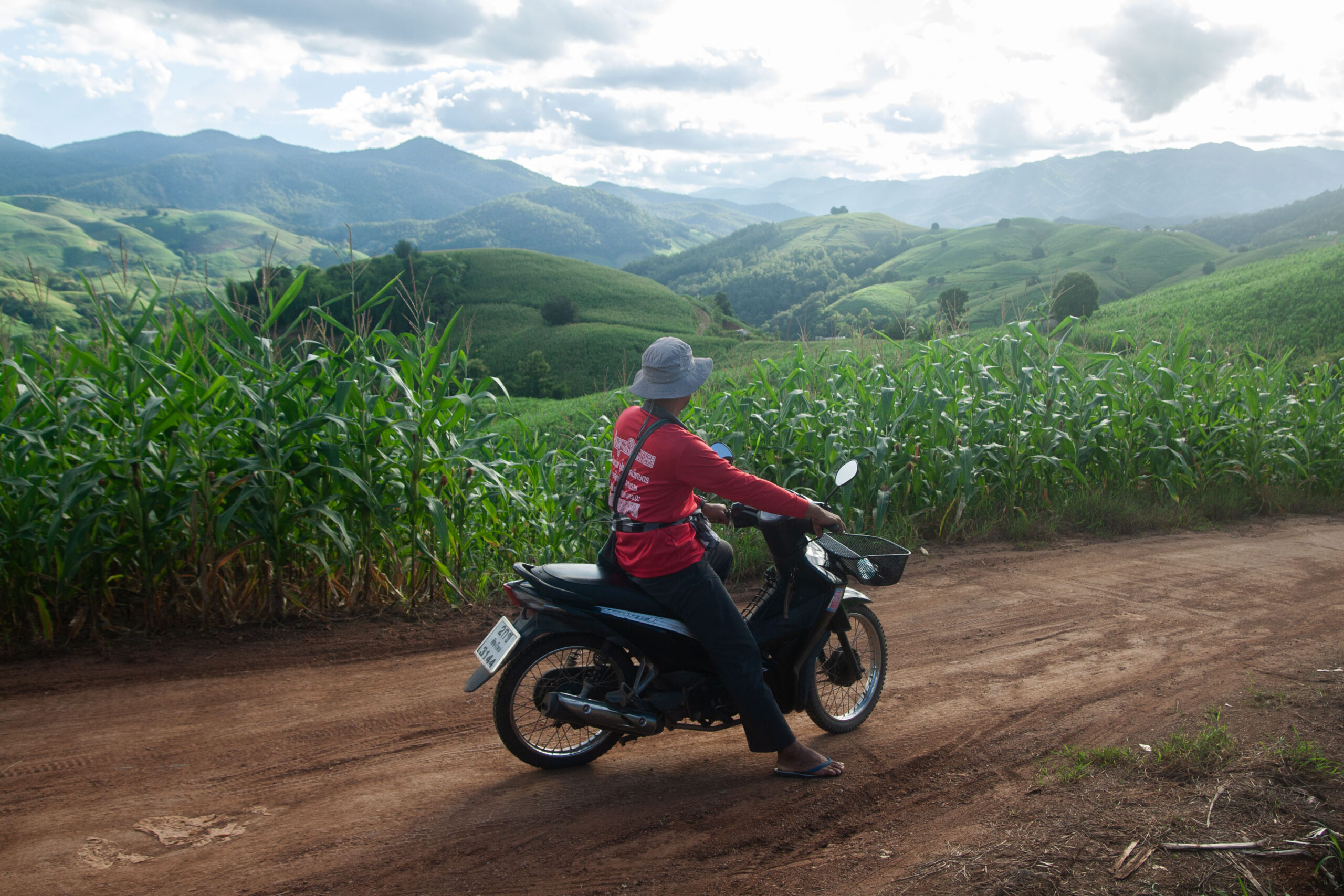
But these comparative victories have come at a cost for many local communities in Thailand, who, according to Warangkana “Nok” Rattanarat, country director of nonprofit RECOFTC’s Thailand office, are often sidelined in the process of drawing protected area boundaries.
This, she told Mongabay in a phone interview, has given rise to conflicts: Communities who have long lived in or around Thailand’s forests have found their activities restricted by officials seeking to uphold the law.
“I don’t think that the [GNW satellite] data is going to actually distinguish between the areas that local people own and the protected areas, because by law these areas are still considered as protected areas,” she said, explaining why deforestation in some Thai protected areas might look higher in GNW’s data.
These problems are by no means unique to Thailand and can be seen beyond the Mekong region, but for Nok, the question remains as to how the authorities at the Department of National Parks, Wildlife and Plant Conservation (DNP) will deal with it.

Relatively strict law enforcement has also played a part in keeping Vietnam’s forests standing, according to Phuc of Forest Trends.
“In Vietnam, I think the government has been imposing entire logging bans on natural forest, so of course there is some illegal logging, but it’s very small,” he said. “The government is very strict in terms of protecting natural forest in Vietnam right now.”
Under laws introduced in Vietnam in 2018, those convicted of illegal logging face up to 15 years in prison, while Thai laws introduced in 2019 include penalties of up to 20 years in prison for the same crime. Both countries have, historically, seen their logging companies operate in neighboring Cambodia, Laos or Myanmar as opposed to domestically, but Phuc noted that high-value timber is becoming harder to find across the region.
“Basically, we are done with the high value, so yes, you still have quite a lot in Cambodia, and some of that in Laos, but you really have to go very deep into forest to get that kind of timber, so it’s becoming a lot more challenging,” he said.
For Phuc, the region’s apparent decline in deforestation could be a result of diminishing supplies of and demand for luxury timber, combined with shifting demand and prices for agricultural commodities, as well Thailand and Vietnam’s outsourcing of agricultural commodities plantations to neighboring countries — just as they did with timber sourcing.
“The global market price for commodities could be a very important reason explaining why the deforestation goes up and down,” Phuc said. “If you look at the key drivers of deforestation in the Mekong region over a 20-year period, it’s all commodities, or what we call forestry commodities. Timber is almost gone.”
*Editor’s note: Mongabay used the Global Forest Watch platform to determine tree cover loss at the national level, but used satellite data published by the Global Land Analysis and Discovery Laboratory at the University of Maryland, together with updated protected area data obtained from civil society groups, to calculate tree cover loss in protected areas.
The format of this data and latitudinal variations across the region have resulted in some minor discrepancies within Mongabay’s data as we chose to use an average pixel-per-square-meter value for each country analyzed to calculate deforestation inside protected areas based on the GLAD lab’s data.
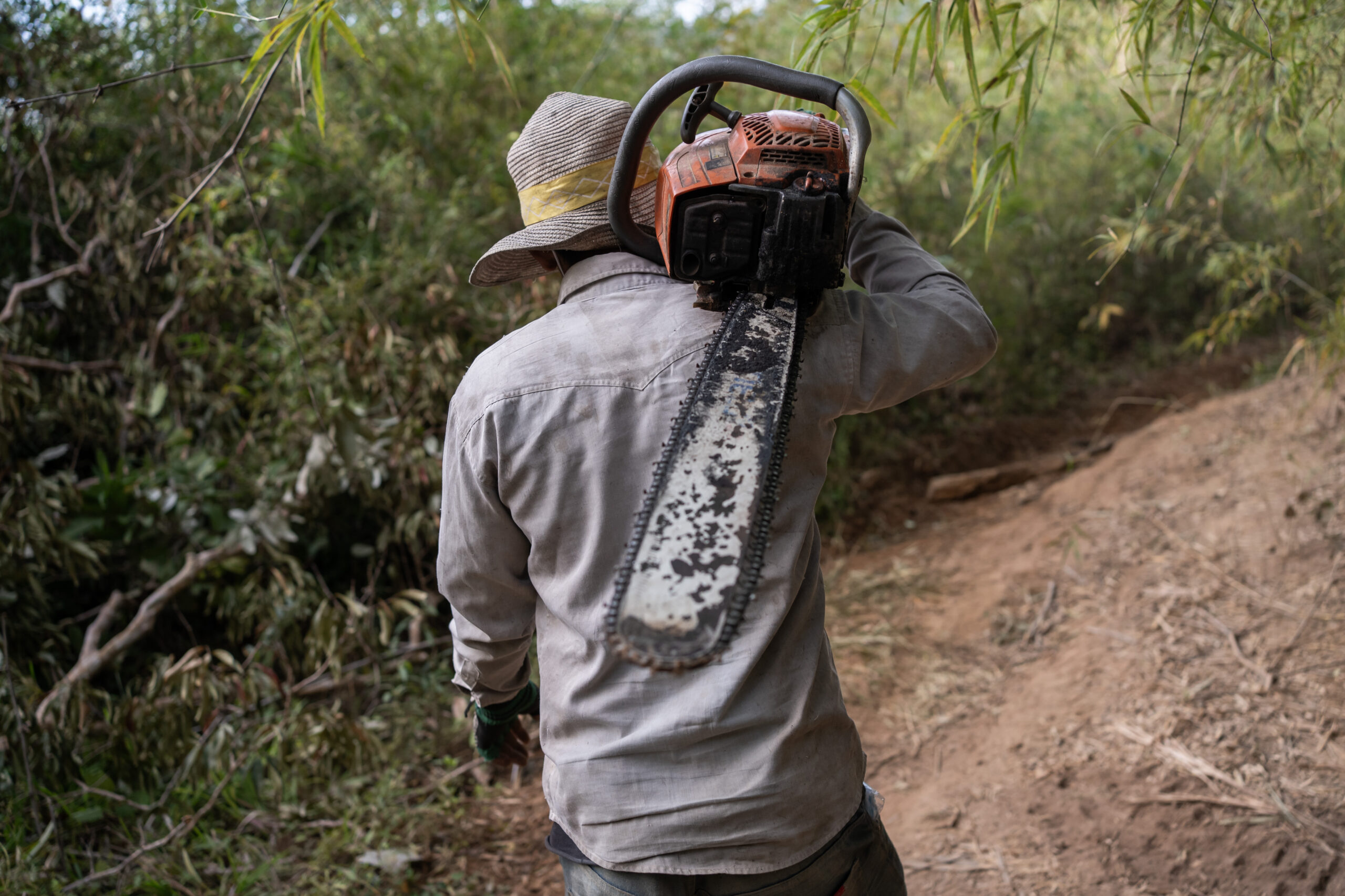
Banner image: A logger carries his chainsaw through the forest of the Cardamom Mountains in Cambodia. Image by Andy Ball / Mongabay.
Cite this article
Gerald Flynn (2026). Despite a drop in deforestation in 2025, forest losses pile up in the Mekong. Mongabay Conservation news. DOI: https://doi.org/10.66709/news-330522

