


- Citizen scientists in Pune are mapping trees along the Mula-Mutha riverbanks using smartphones, measuring tapes and the iNaturalist app to document urban biodiversity.
- The data are strengthening conservation efforts by providing evidence against tree felling and advocating for sustainable alternatives to engage citizens.
- From protecting the ecologically rich Ram-Mula Devrai to drawing on global citizen science initiatives, Pune’s volunteers are part of a larger trend in community-led documentation that can help safeguard urban green spaces and influence conservation decisions.
PUNE, India — On a quiet Saturday morning, away from the usual urban rush of Pune, citizens gather at the Madhavrao Scindia Garden along the banks of the Mula River. Out on the water, two fishers quietly navigate their boat surrounding a dense forested area on the other side of the river; the cooling shade and chirping birds feel like a natural alarm that you would want to listen to every day.
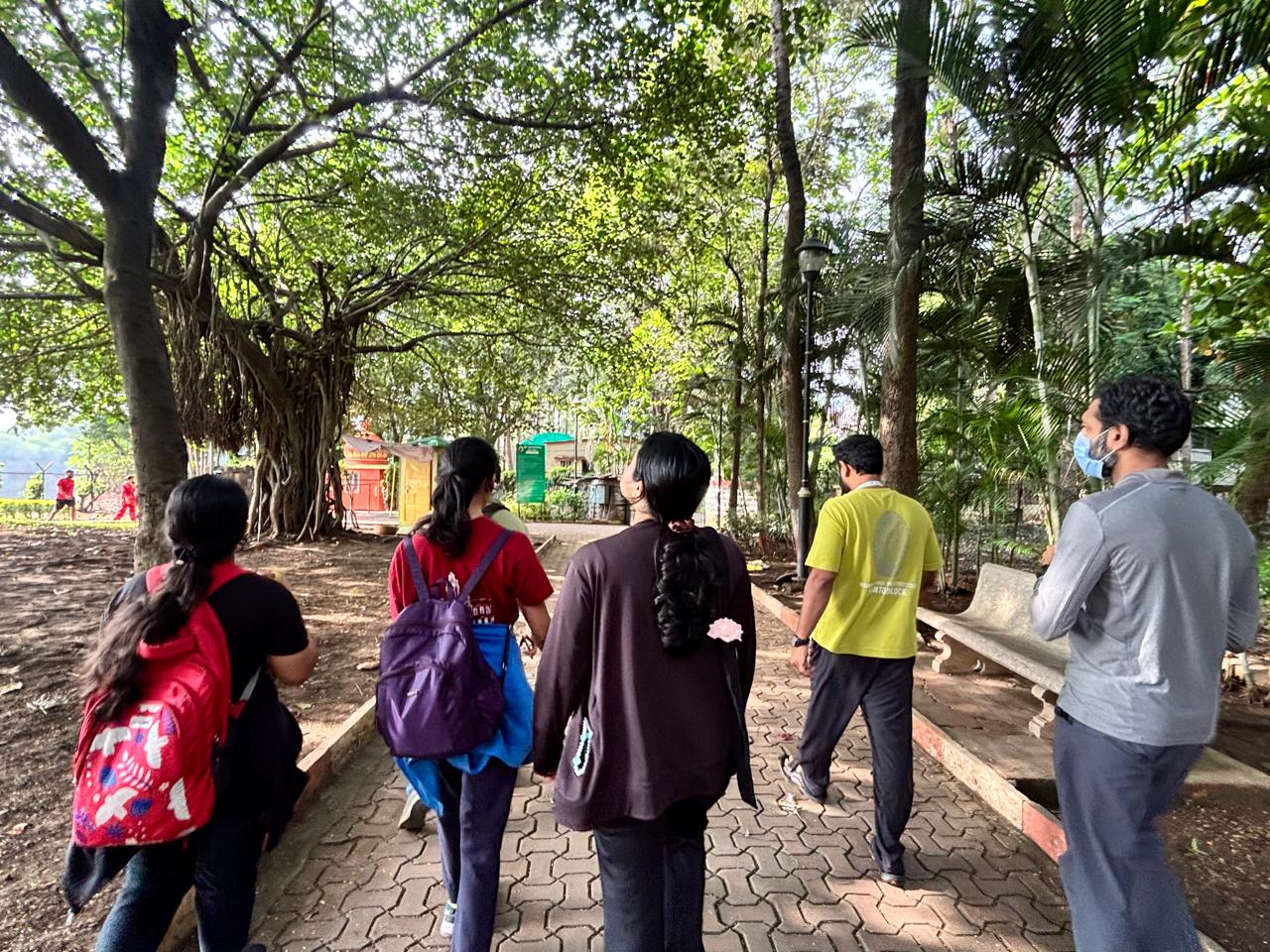
Such a setting is increasingly rare in a bustling metropolis like Pune, where the population is estimated at 7.9 million, yet these volunteers arrive every weekend equipped with measuring tapes, smartphones and a keen curiosity to explore and document the trees in the city’s riparian zones. On this particular Saturday, a group of seven visits a city park along a riverbank, where trees stand tall against the sky.
The volunteers belong to Pune River Revival, a grassroots movement formed in response to the Pune Riverfront Development Project, a large urban redevelopment plan along the Mula-Mutha rivers aimed at creating promenades, recreational spaces and infrastructure along the riverbanks. The total estimated cost of the project is around 4,727 crore rupees (about $500 million).
“We started organizing the tree mapping exercise systematically in 2024,” explains Raghunandan Patil, a volunteer with the group. “While our volunteers used to do tree mapping earlier manually, at that time, the group was not well-versed in the technical details of how to map a tree properly and create thorough documentation.” Patil adds that now they use a citizen science app called iNaturalist, which helps them map trees with a click of their fingertips, all easily accessible and documented in specific projects present in the app.
This Saturday, the volunteers are mapping trees under the Mutha River biodiversity citizen science project within the app.
To cover the ground efficiently, the volunteers split up along assigned stretches of the riverbank. Each person works down one side, inputting detailed observations directly into iNaturalist. Mapping the trees doesn’t just end as a weekend hobby but it goes much further, serving as evidence that helps activists and environment experts when issues and questions arise. Raghunandan recalls a recent incident in which 529 trees were felled along Ganeshkhind Road in Pune. “Our main focus from tree mapping is to protect the riparian zones in the city, but because of requests from citizens, we mapped more than 500 trees within a month’s time to collect evidence,” Raghunandan says.
Media reports state that citizen tree mapping has documented 53 species of trees in the area, including banyan, Chinese banyan (Ficus microcarpa), weeping fig trees (Ficus benjamina) and yellow flame trees (Peltophorum pterocarpum).
Ananya Gandhi, a 24-year-old Pune resident who has been mapping the city’s riparian zones for two years, opens the app and starts by logging a photo of a mature jackfruit tree (Artocarpus heterophyllus). She estimates its height, measures the trunk circumference using a tape, calculates the girth and uploads the data point to the project map.
“Having lived in Pune all my life, I have seen how drastically the city has changed,” says Gandhi. “It was different when I was a child, but now there is so much pollution and heat.”
“Over the years, the city has lost its charm. The city known for a peaceful, slow, gentle, cool life is filled with dust and air pollution making it very hard to breathe. Temperatures have seen an increase due to deforestation,” she adds. According to the monitoring platform Global Forest Watch, Pune lost 40 hectares (roughly 100 acres) of natural forest in 2025 alone.
Gandhi will soon move to Sweden to pursue higher studies, but she views this volunteer work as a meaningful contribution to her home city and plans to remain active in similar environmental initiatives while abroad.

Turning data into conservation evidence
What began as an informal effort to prevent tree felling for riverfront infrastructure has grown into a structured evidence-gathering initiative for Pune’s biodiversity. According to Raghunandan, documenting these trees serves various purposes.
“Personally, I want to protect the environment, but without this data, we cannot even grasp how much damage has already occurred. So to any nature lover, this gives an idea on what’s left to be saved. Apart from this, tree mapping provides evidence to present to the government or authorities when advocating for sustainable alternatives.”
Ashok D. Ghorpade, joint municipal commissioner and chief garden superintendent, Pune Municipal Corporation, explains that PMC conducts regular tree censuses in accordance with a Maharashtra state urban preservation act that dates to 1975. This happens every five years, using GIS and other modern technologies. Citizen mapping projects complement the government’s data.
“The process involves field-level enumeration and geo-tagging of individual trees, recording relevant attributes such as species, trunk girth, height, geographical coordinates and photographs, and compiling the collected information into a GIS-based digital database,” Ghorpade says.
However, the government tree census has been criticized by environmental activists and experts in the past for having gaps and inconsistency.

While government authorities conduct these official censuses, “citizen-generated tree data is welcome as supplementary information during the tree census process,” Ghorpade explains.
“Information submitted by citizens, environmental organisations and other stakeholders may be considered for inclusion in the official tree census database, subject to validation and verification by the agency appointed by PMC and in accordance with the prescribed procedures and technical standards.”
Documenting a sacred grove
Raghunandan points to the Ram-Mula Devrai, a sacred grove located at the confluence of the Ram and Mula rivers, as a key example of how citizen data can change outcomes.
A devrai is known as a sacred patch of forest traditionally protected by local communities because it is believed to be the home of a village deity. Official reports show that this area is home to 1,000 heritage trees, at least 450 flora and fauna species and 160 bird species, including protected wildlife such as the Bengal monitor (Varanus bengalensis) and checkered keelback snake (Fowlea piscator). Satellite imagery, nesting records and temple documentation further affirm the grove’s ecological and cultural value.
“We documented the Ram-Mula Devrai to highlight its ecological value to both the public and local authorities, rather than letting those trees be cut down,” Raghunandan notes. “We organized butterfly walks, insect walks, tree-painting competitions and other sustainable activities. We gave an alternative to the government that the area could be commercialized sustainably instead of clear-cutting the forest. As a result, that stretch now faces a much lower risk of heavy development.”

Growing global citizen participation in tree conservation
Pune’s community-driven conservation strategy reflects a broader global trend. In Hyderabad, India, the Save KBR Park campaign recently released a geotagged map of 672 trees to safeguard vital urban forest cover against road expansion projects. In the United States, student-led initiatives like Winchester’s tree preservation survey in the state of Massachusetts are mobilizing residents to document local tree canopies. Meanwhile, platforms like the U.K.-based Treezilla demonstrate how crowdsourced citizen data can create a massive, open-access map of urban trees to quantify ecosystem benefits and support climate resilience.
Research shows these efforts are effective. In a 2017 study comparing volunteer-collected tree data with expert assessments across four cities in the U.S. and Sweden, volunteers were 90% consistent with experts for site type, land use, dieback and genus identification. Within correct genera, participants recorded species consistent with experts for 84.8% of trees, although accuracy varied by the type of data collected. The researchers recommended quality checks and simpler methods for certain measurements to improve reliability.
Beyond its policy value, tree mapping also offers volunteers moments of unexpected hands-on discovery. Vivek Lanjawa, a college student who regularly joins the weekend drives in Pune, gets fascinated by a natural gum he notices oozing from a bark seam during a mapping session. He later identifies it as sap from a Moringa oleifera (drumstick) tree, a fast-growing, drought-resistant species.
At the end of two hours, the group gathers on the Mula riverbank for a photo. Before dispersing back into the city, the volunteers share warm cups of tea, already anticipating the next stretch of riverbank to explore the following weekend.
Banner image: A group of volunteers walk toward a tree mapping area. Image by Stephin Thomas.
Citation:
Roman, L. A., Scharenbroch, B. C., Östberg, J. P., Mueller, L. S., Henning, J. G., Koeser, A. K., … Jordan, R. C. (2017). Data quality in citizen science urban tree inventories. Urban Forestry & Urban Greening, 22, 124-135. doi:10.1016/j.ufug.2017.02.001
Cite this article
Stephin Thomas (2026). How citizen scientists are mapping Pune’s trees, with hopes of a greener future. Mongabay Conservation news. DOI: https://doi.org/10.66709/news-334527

