


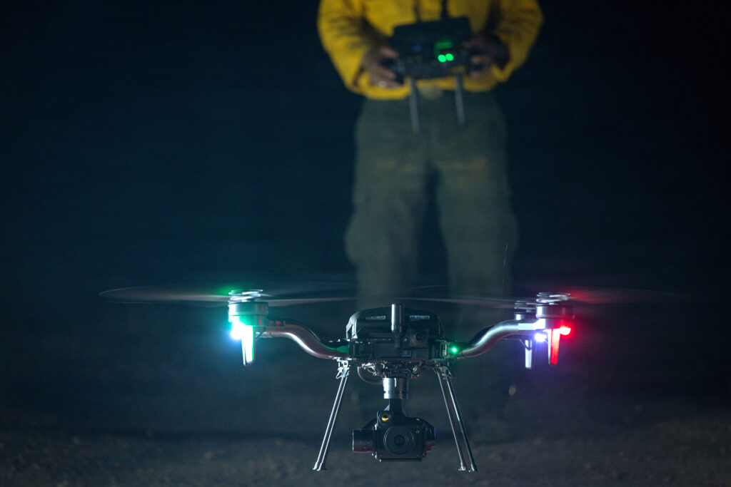
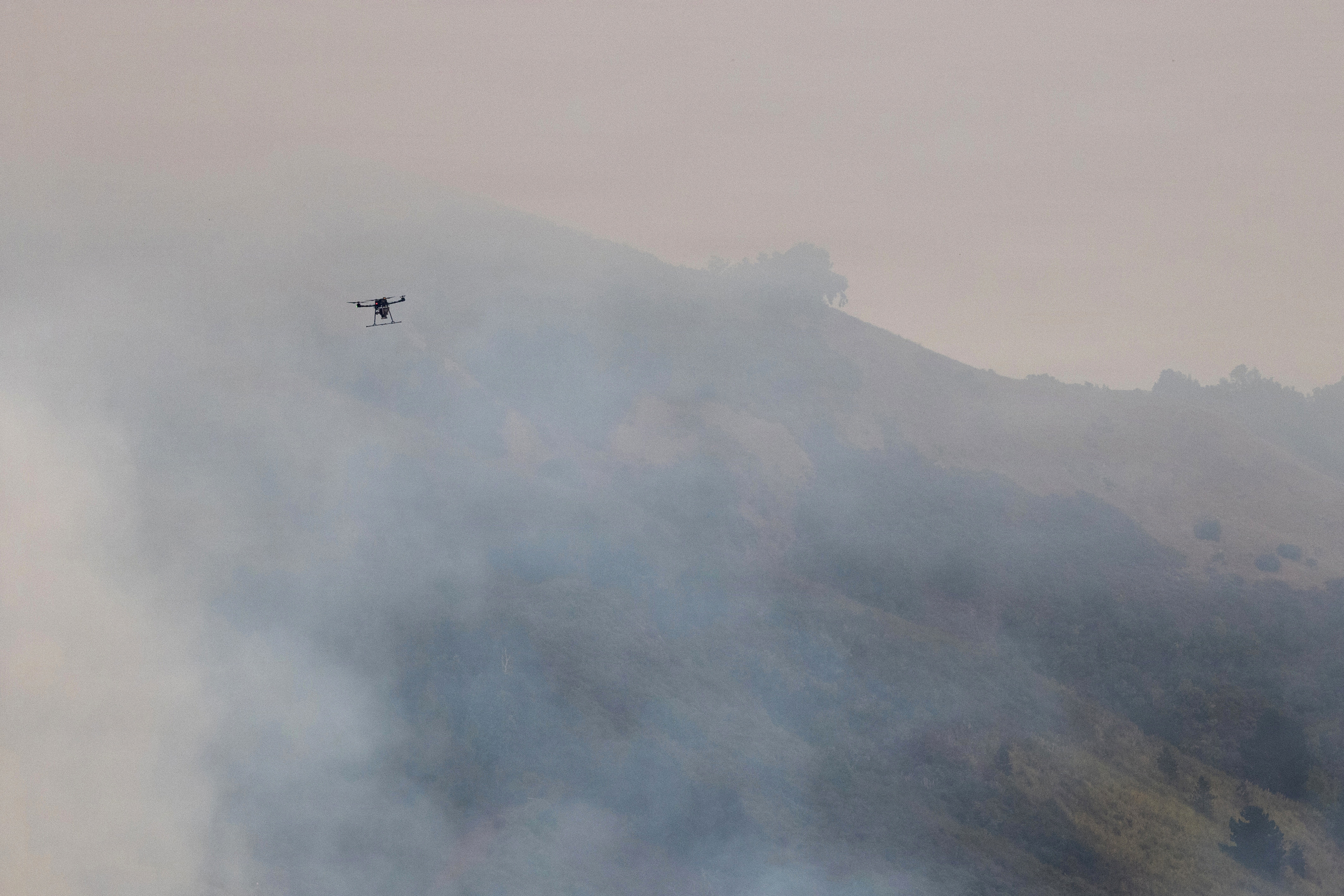
During the Sand Creek Fire, which has burned since the start of August in southwestern Montana, difficult terrain and fire-weakened trees posed hazards to crews searching for areas still smoldering on steep slopes after the blaze passed. So instead of relying only on firefighters to find hidden embers, fire managers used unmanned aircraft to seek out heat sources.
The operation is part of a broader technological shift underway in wildfire response. The U.S. Forest Service is evaluating firefighting robots on the ground, and researchers are exploring how artificial intelligence could help predict where wildfires will ignite and how quickly fires will spread. Federal agencies already use drones to map fires, detect hotspots and ignite prescribed burns, and are testing their capability to drop firefighting foam and water on blazes.
“Drones are now a critical tool in federal wildfire response, providing real-time infrared imagery to map fire perimeters, detect hotspots, and monitor dangerous or inaccessible terrain, which helps firefighters make safer, faster tactical decisions,” said Meredith Hollowell, a Forest Service press officer, in a statement to Inside Climate News.
The Federal Aviation Administration said drones provide real-time situational awareness by detecting hotspots, mapping fire perimeters and aiding firefighter efforts in dangerous environments.
But drones are no longer being used just to watch fires from above.
During aerial ignition operations in which fire managers intentionally burn vegetation to expand control lines or remove fuels before the main fire reaches them, unmanned aircraft can reduce the exposure of pilots or firefighters to some high-risk conditions, Hollowell said.
The technology has become established enough that federal agencies now have specific positions for UAS pilots, managers, module leaders and data specialists, as well as procedures for ordering drone resources for wildfire incidents.
Robots on the Fireline?
The Forest Service is also testing unmanned ground vehicles that could move equipment through rugged terrain, Hollowell said. Ground robots provide similar advantages to aerial drones: they let machines perform tasks in places where people may face unnecessary hazards like falling trees, steep and rugged terrain with the potential for dangerous falls and rapidly changing fire behavior. But while aerial drones are already part of federal wildfire operations, robots remain an emerging technology being tested for possible future use.
The Forest Service is also testing autonomous ground vehicles that could carry equipment and supplies into areas where conventional vehicles or manual transport may be difficult or unsafe. In June, the agency and its partners tested robotic vehicles on rough terrain in Georgia that was designed to replicate conditions encountered during wildfire operations.
The vehicles were expected to carry payloads of up to 800 pounds, including firehose packs, heavy hand tools, water containers and medical supplies. Evaluators tested their ability to navigate rocky roads, uneven ground and slopes while carrying operational loads.
While the technology is not yet ready for routine wildfire operations, Charlie Gray, a Forest Service district fire management officer, said it shows promise for reducing firefighters’ exposure to risk while getting equipment and supplies to the fireline.
Artificially Intelligent Drones
Hollowell said the Forest Service expects advances in AI-enabled unmanned aerial systems, combined with improved fire-behavior models and data from satellites, cameras and weather models to revolutionize wildfire detection and tracking, suppression efficiency and firefighter safety.
Researchers are already examining the potential advantages of combining drones with artificial intelligence.
Phinehas Lampman, a researcher at the University of Idaho, developed a system using thermal-infrared images collected by drones and machine-learning models to analyze fire behavior and predict a fire’s rate of spread. Lampman spent seven years working on engine and hotshot crews for the Clearwater-Potlatch Timber Protective Association and the Forest Service before turning to research, according to his University of Idaho bio.
This story is funded by readers like you.
Our nonprofit newsroom provides award-winning climate coverage free of charge and advertising. We rely on donations from readers like you to keep going. Please donate now to support our work.
Lampman’s study, published in May in the International Journal of Wildland Fire, focused on three measures of fire behavior: rate of spread, fireline intensity and radiative power. Researchers repeatedly flew a drone equipped with a thermal-infrared sensor over a prescribed grassland fire and used the imagery to generate high-resolution measurements of those characteristics.
Lampman and his colleagues used the drone-collected data to train machine learning models to predict how quickly the fire would spread. The models performed well in making short-term predictions during the experiment, the researchers reported. Drones that can collect observations directly from a fire for machine-learning systems to analyze for their predictions of what the blaze may do next could be a valuable addition to incident commanders’ toolbox.
Fire managers currently make decisions using multiple sources of information, including weather reports, maps, observations from firefighters and aerial information from airplanes and helicopters.
“Most incident commanders in the field rely on their vast experience to assess and ultimately predict wildfire movement,” Lampman said in an August article published by the University of Idaho.
But while conventional aircraft can provide critical information, they cannot operate in all conditions.
“Sometimes those aerial assets are grounded, or the visibility is really poor,” Lampman said. “But drones can usually still fly and gather information.”
That could make drones useful not only as another set of eyes over a fire, but also as a data source for models designed to estimate fire behavior.
Lampman’s research remains a proof of concept, and no AI system yet exists that fire managers can rely on to accurately predict a wildfire’s movement. But federal fire officials are already looking toward a future in which drones, artificial intelligence and other technologies could work together to give firefighters more information while reducing their exposure to dangerous situations.
“Looking ahead, advances in AI-enabled UAV systems, improved fire-behavior modeling, and expanded use of decision-support tools, along with satellite, camera, and weather-model integration, are expected to enhance early detection, tracking, suppression efficiency, and firefighter safety,” said Hollowell, at the U.S. Forest Service.
Researchers are also exploring how drone-collected data could improve models of wildfire smoke and its potential effects on people downwind.
“UAS provide critical access to researchers who are expanding our understanding of the relationships between fire behavior and smoke emissions in real time,” Leda Kobziar, a professor of wildland fire science at the University of Idaho and a co-author of the study, said in an email to Inside Climate News. “These relationships are key to building and improving models (including AI models) that can help us predict what types of smoke-borne microbes and concentrations of smoke we would expect people downwind to be exposed to.”
About This Story
Perhaps you noticed: This story, like all the news we publish, is free to read. That’s because Inside Climate News is a 501c3 nonprofit organization. We do not charge a subscription fee, lock our news behind a paywall, or clutter our website with ads. We make our news on climate and the environment freely available to you and anyone who wants it.
That’s not all. We also share our news for free with scores of other media organizations around the country. Many of them can’t afford to do environmental journalism of their own. We’ve built bureaus from coast to coast to report local stories, collaborate with local newsrooms and co-publish articles so that this vital work is shared as widely as possible.
Two of us launched ICN in 2007. Six years later we earned a Pulitzer Prize for National Reporting, and now we run the oldest and largest dedicated climate newsroom in the nation. We tell the story in all its complexity. We hold polluters accountable. We expose environmental injustice. We debunk misinformation. We scrutinize solutions and inspire action.
Donations from readers like you fund every aspect of what we do. If you don’t already, will you support our ongoing work, our reporting on the biggest crisis facing our planet, and help us reach even more readers in more places?
Please take a moment to make a tax-deductible donation. Every one of them makes a difference.
Thank you,

Fellow
Mosabber Hossain is an Inside Climate News Fellow and an award-winning climate and environmental investigative journalist from Bangladesh. His reporting focuses on climate change, biodiversity, environmental justice, adaptation and corruption. His work with Reuters and other international outlets has been republished globally, and some of his reporting contributed to discussions featured on the agenda of the World Economic Forum. Mosabber is a graduate student at the University of Montana studying environmental science and natural resource journalism. Previously, he was a fellow with the Institute for Journalism and Natural Resources and Investigative Reporters and Editors. He is a recipient of the South Asian Investigative Journalism Award from the Thomson Foundation and was featured among eight journalists during the organization’s 60th anniversary for the impact of his investigative reporting. Mosabber is also a wildlife and nature photographer whose work has been published internationally.
