


By Susanne P. Schwenzer, Professor of Planetary Mineralogy at The Open University, UK
Earth planning date: Friday, Aug. 7, 2026
This week was very special for the Curiosity team here on Earth as we celebrated the 14th landing anniversary. I still remember watching the buildup to the entry phase on “Eyes on the Solar System” and then I don’t remember much until I heard the words, “We are safe on Mars.” I was just too tense and nervous, but I love to re-live the moments each year when we celebrate another (Earth) year on Mars. If you want to remember it all, you can go to NASA’s interactive tool “Eyes on the Solar System” use the menu and find the Mars Science Laboratory Rover in the list of spacecraft. Curiosity launched Nov. 26, 2011, 15:02 UTC; you can wind back the clock to that day as the spacecraft leaves Earth and follow as it gradually makes its way to Martian orbit, where it meets Mars at just the right moment. Curiosity landed Aug. 6, 2012, 05:17 UTC. The big moment to me, though, is to see the joy and celebrations in the control room after landing. I have watched this video more times than I can count; it’s just too good to not remember: Curiosity Has Landed – NASA Science.
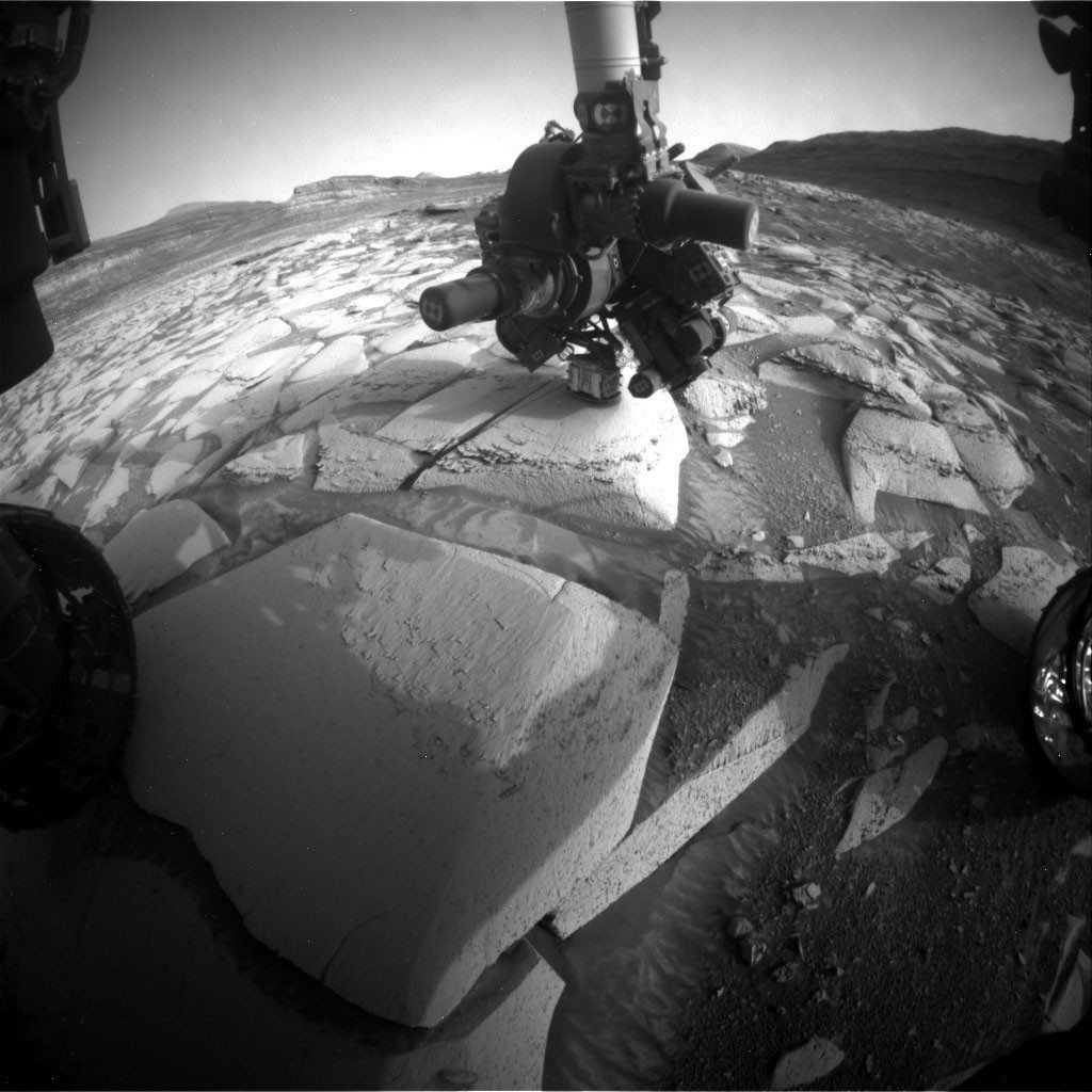
But what did we do in that very special week that marked the transition from year 14 to year 15? Of course it was business as usual for the rover while many of us exchanged memories and also marveled at what we have found to date. If you are interested what exactly Curiosity did at the moment in time that marked the landing anniversary, we’ve got you covered — with the help of the science and engineering team at JPL in Pasadena, I can tell you that this was on Sol 4976 at 19:47 LMST on Mars, and at that very moment the rover’s arm was deployed at the target “Tunas Khasa” doing an APXS measurement.
The rover continued its way up Mount Sharp investigating the different layers of rock along the way. This climb can be quite steep and coming into Monday’s plan was no different. At one point last Friday the rover’s tilt was 24 degrees. But the engineers know exactly what Curiosity can do, so we arrived safely at our planned location coming into Monday. At this first stop of the week, the APXS measured “Tunas Khasa” and “Villarrica,” which were also imaged with our Mars Hand Lens Imager (MAHLI). More chemistry came from ChemCam investigating the targets “Lago Rupanco” and “Chulipa Punta.” ChemCam also used its Remote Micro Imager to acquire high-resolution images of targets of interest. We are specifically looking for the cross-bedding, a term geologists use to describe rock layers that tilt and intersect each other, and how the different layers of rock relate to each other. Mastcam had five different mosaics in the plan, investigating targets in the nearfield and looking into the distance, too. The targets range from layers of rocks in the walls that make up the buttes around the rover to bedrock targets in the nearfield. “La Linea” is a surface that displays signs of erosion, and “Tiraque” gives insights into the layering of the bedrock, just to name two of the Mastcam targets. Of course, the future drive direction and the future workspace were also imaged after the drive. In addition to the science, there were some “housekeeping” activities in the plan, too. Those were a SAM column-cleaning activity and MAHLI images of the REM UV sensor. It’s important to keep on top of these things, too!
The 46-foot (14-meter) drive put us into the perfect position in front of one of those very special places, where not only two different rock layers meet, but also where cross-bedded rocks are truncated by other layers. It is those special places that allow us – one by one – to put the pieces of the puzzle together, showing what happened here billions of years ago. One thing is clear: it involved wind, lots of wind, but also some water. As this location is an exceptionally interesting place, we will stay here through Monday and spend two planning cycles at this location.
On Friday we planned two APXS on a bedrock block in front of us – keeping in mind two others for our colleagues to plan on Monday. The two targets are “Salar de Gorbea” and “Uriondo.” MAHLI documents those two, but also has a mosaic in the plan that is one of the largest I have ever seen. It’s on the target “Tres Morros,” which is an excellent example on how exactly those different rock layers meet. The team can’t wait to see the high-resolution MAHLI images and inspect every single detail visible in them. Mastcam also was very busy, investigating representative outcrops in the nearfield and further away. Targets to especially look out for are “Laguna Del Eulogio” and “Laguna de Pozuelo,” as they image outcrops related to the changes in the rock layers and further ahead on a butte called Mishe Mokwa. You might remember the latter from many mentions previously as we were driving along and around it, and using repeated images to get stereo views, but also understand different aspects of the stratigraphy (the way rocks are layered). ChemCam looks at target “Rio Tranquilo,” which is a nodular target, possibly giving insights into the water-related part of the environments that formed those rocks. The other ChemCam target is “Rio Juncalito,” which is a cross-bedded target. ChemCam also has two RMIs in the plan, one targeting forward toward Valle Grande and the other looking at Mishe Mokwa.
Both plans contain a rich set of environmental monitoring. There are many dust-devil surveys alongside measurements of the atmospheric opacity and wind monitoring. We are also looking for clouds, and of course the RAD instrument is actively measuring the radiation environment. It rarely gets a mention here, because it sits quietly in its place within the rover, looking out to the sky and monitoring the radiation — for all those 14 years, and in fact a little longer, because it was the first instrument to be switched on after launch and already started its monitoring during the cruise phase to Mars.
Happy 14th Landing Anniversary, Curiosity!
